Difference between revisions of "Day 7"
From Bambi
m (→Wave Front) |
(→Log) |
||
| Line 7: | Line 7: | ||
#* <code>export GAZEBO_RESOURCE_PATH=$GAZEBO_RESOURCE_PATH:~%BAMBI-GIT-ROOT%/gazebo</code> | #* <code>export GAZEBO_RESOURCE_PATH=$GAZEBO_RESOURCE_PATH:~%BAMBI-GIT-ROOT%/gazebo</code> | ||
#* <code>export GAZEBO_MODEL_PATH=$GAZEBO_MODEL_PATH:~%BAMBI-GIT-ROOT%/gazebo/models</code> | #* <code>export GAZEBO_MODEL_PATH=$GAZEBO_MODEL_PATH:~%BAMBI-GIT-ROOT%/gazebo/models</code> | ||
| + | # Successfully implemented WP navigation to orthophoto target position | ||
= Coordinate Reference System = | = Coordinate Reference System = | ||
Latest revision as of 01:40, 11 August 2018
Log
- Use
geodesypackage for GSM84 --> UTM coordinate transformation-
sudo apt install ros-kinetic-geodesysee http://wiki.ros.org/geodesy - UTM Coordinate frame more or less squares of 180km
-
- Modified bambi gazebo world and model path. Now they are placed under
"bambi_ws"/gazebo. REMEMBER to add the following in.bashrc:-
export GAZEBO_RESOURCE_PATH=$GAZEBO_RESOURCE_PATH:~%BAMBI-GIT-ROOT%/gazebo -
export GAZEBO_MODEL_PATH=$GAZEBO_MODEL_PATH:~%BAMBI-GIT-ROOT%/gazebo/models
-
- Successfully implemented WP navigation to orthophoto target position
Coordinate Reference System
In UTM (Northing, Easting, Down) reference system is positive toward north pole (toward map top) and toward east (toward the map right)
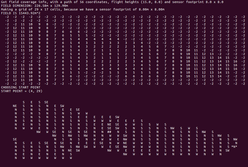
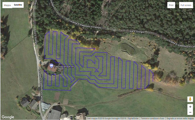
Wave Front
Visualized on Google Maps it becomes:

